Geolocation Settings
The Geolocation options for digiKam are set from . These settings control the multiple map views within digiKam.
Map View Settings
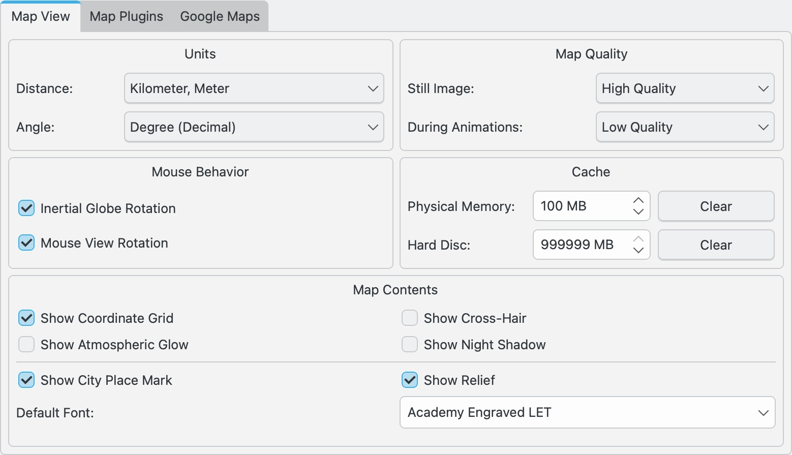
The Map View tab allows you to control the displays and behaviors within the digiKam map views.

The digiKam Geolocation Map View Settings Page
- The options that can be set in this page include:
- Units
Distance sets the distance units (km, miles, nautical miles) used in the map displays.
Angle set the angle units (decimal degrees, DMS, UTM) used in the map displays.
- Map Quality
Still Image sets the quality (resolution) of the map display when the display is still.
During Animations sets the quality (resolution) of the map display when during animations. Higher quality will be slower.
- Mouse Behavior
Inertial Globe Rotation
View Rotation
- Cache
Physical Memory
Hard Disc
- Map Contents
Show Coordinate Grid
Show Cross-Hair
Show Atmospheric Glow
Show Night Shadow
Show City Place Mark
Show Relief
** Default Font**
Map Plugins Settings
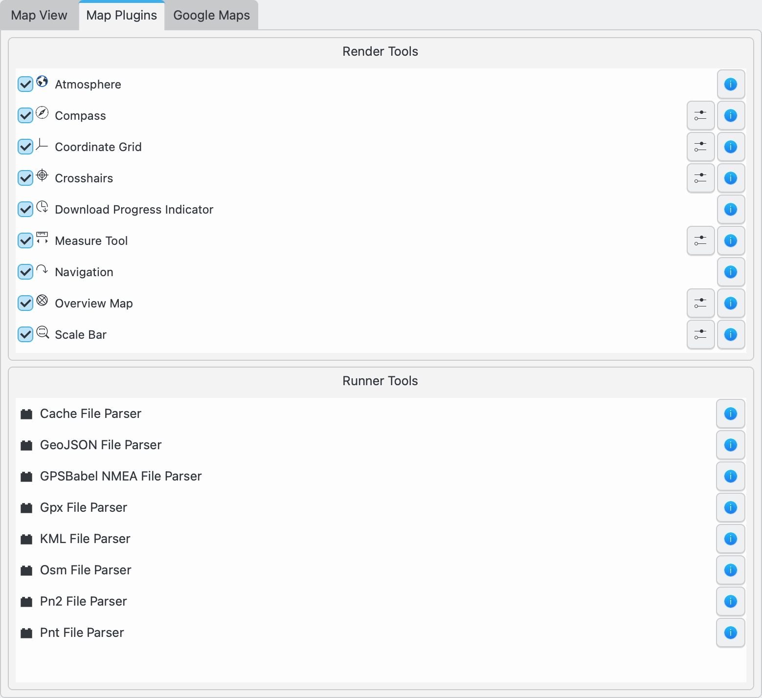
The Map Plugins tab lists all of the map plugins installed in digiKam, and allows the user to toggle on or off those plugins that control map overlays. Settings are also available to further customize some of the overlays.

The digiKam Geolocation Map Plugins Settings Page
The map render tools that produce the overlays include: Atmosphere, Compass, Coordinate Grid, Crosshairs, Download Progress Indicator, Measure Tool, Navigation, Overview Map, and a Scale Bar.
The runner plugins used to parse GPS files are also listed.
Google Maps Settings
The Google Maps tab allows you to enter an API key to use Google Maps. Google Maps is usable without this key, but will overlay the maps with the words “For Development Only”. See this page for more information.

The digiKam Geolocation Google Map Settings Page